

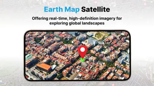
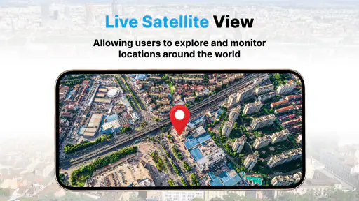
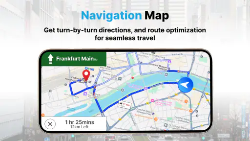

I approached Earth Map Satellite Live View as a practical map companion rather than a replacement for every navigation tool on my phone. Developed by Synlox Studio, this free Maps & Navigation app combines a satellite-focused view with GPS navigation, so its appeal is easy to understand: it lets me look at places from above while also helping me orient myself on the ground. That combination makes it more interesting than a plain street map, especially when I want visual context before moving through an unfamiliar area.
My overall impression is positive but specific. I would recommend it to someone who enjoys exploring geography, checking the shape of a destination, or using satellite imagery as part of a simple navigation routine. I would be more cautious about recommending it as a sole travel tool for complicated journeys. Its value depends on whether you want the visual perspective of an Earth map or the deep, all-purpose travel ecosystem offered by the most established navigation alternatives.
What I would consider before installing it
The first decision is about the kind of map I actually need. If I am trying to find a business, compare public transport options, save a large collection of places, or receive highly detailed local guidance, I usually expect more than a satellite view and basic GPS assistance. If I want to understand the layout of a coastline, inspect the surroundings of a hiking destination, or get a better sense of how a neighborhood fits together, a satellite-centered app feels much more natural.
I also look at how much effort an app demands during a trip. A useful navigation tool should make it easy to identify where I am, understand the direction I am facing, and switch from broad exploration to practical movement without making me fight the interface. With this app, I found that the satellite perspective is the main reason to stay. It gives the map a more physical, visual quality than the abstract lines and colored blocks used by many conventional map applications.
There is also a question of trust. A GPS position can help me orient myself, but the view on the screen is not a substitute for observing signs, terrain, road conditions, or local restrictions. I treat the app as an aid for awareness rather than an authority. That matters most when I am walking somewhere unfamiliar or using the imagery to judge whether a path, access road, or open area is genuinely usable.
The app is free to install, which makes trying it low-risk. Optional in-app purchases range from around four dollars to around fifteen dollars per item. I would therefore begin with the free experience and only consider paying after deciding whether the satellite workflow is something I would use regularly. The age rating is Everyone, so the presentation is suitable for a broad audience, including casual users who simply want to explore the planet visually.
How the satellite view changes the way I use a map
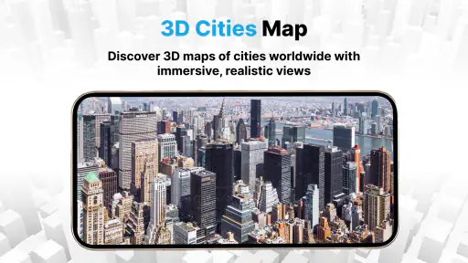
The strongest part of the experience is the shift from symbolic mapping to visual interpretation. A normal map tells me that a road exists and shows how it connects to another road. Satellite imagery can help me see the surrounding fields, buildings, water, tree cover, and general shape of the area. That difference is useful when the question is not only “How do I get there?” but also “What will this place look like when I arrive?”
I found this especially valuable before visiting outdoor locations. For example, if I am planning a walk near a lake, I can use the overhead perspective to understand where the water sits in relation to nearby roads and developed areas. I can also get a clearer impression of whether a destination is surrounded by dense construction or open land. I would not treat that impression as a guarantee of access, but it helps me prepare more intelligently than a simple road diagram would.
Another practical use is checking a meeting point that is difficult to describe. A friend might tell me to meet near a large building, a parking area, or a distinctive bend in a road. Satellite imagery can make those landmarks easier to recognize from above. I can study the relationship between the destination and nearby features before leaving, which reduces the chance of arriving in the right general area but missing the exact entrance.
My favorite non-obvious use is pre-trip orientation. Instead of waiting until I am already lost, I can look at the destination while I am still at home and mentally trace the approach. I pay attention to the final turn, the nearby open spaces, and the direction of the main road. This small preparation step makes GPS guidance less stressful because I already have a visual idea of what I am trying to reach.
There is a trade-off, though. Satellite imagery can be visually rich while being less immediately readable than a clean road map. Dense roofs, trees, shadows, and parking areas can blend together. When I need to make a quick turn decision, a conventional map may communicate the road structure faster. I see the satellite layer as a planning and orientation advantage, not as the best display for every second of a journey.
Everyday navigation: a realistic test
Imagine that I am visiting a town for the first time and need to reach a rented apartment near the edge of a built-up area. Before leaving, I use the app to inspect the destination and its surroundings. I look for the main approach road, nearby blocks, and the shape of the area around the building. If the final location is close to a river, park, or large open space, the satellite view may give me a helpful landmark that a standard map would show less vividly.
When I start moving, I use GPS navigation to maintain my orientation, but I do not stare continuously at the imagery. I check the route, then compare the real surroundings with the visual pattern I saw earlier. If the entrance is not obvious, I can use the broader satellite context to understand whether I am approaching from the correct side. This workflow is more useful than simply opening the app at the last minute and expecting the screen to solve every problem.
For a daily commute, the benefit may be smaller. Once I know the route, I usually care more about speed, traffic information, rerouting, transit details, and clear turn instructions than about the appearance of the surrounding land. In that situation, a mainstream navigation service may fit better. Earth Map Satellite Live View becomes more compelling when I am exploring, preparing, or trying to understand a place rather than repeating a familiar journey.
Where this app has a clear advantage
Its best advantage is visual context. The app gives me a reason to look at a map beyond following a line from one address to another. Satellite imagery can reveal the physical character of a location, which is useful for travelers, curious explorers, students, photographers planning a visit, and anyone who thinks spatially.
I also like that the app combines exploration with GPS navigation instead of treating them as completely separate activities. I can begin with a broad look at an area, focus on a destination, and then use my position to relate the screen to the real world. That continuity makes the app feel more purposeful than a satellite image viewer that has no practical connection to movement.
The large user base also suggests that the concept has reached beyond a tiny specialist audience. It has passed five million installs and holds an average rating of 3.7 from around 5,700 ratings. I do not read those figures as proof that it will suit everyone, but they do make the app feel established enough to merit a fair trial rather than dismissing it as an experimental curiosity.
Another strength is accessibility. Because the app is free to start and carries an Everyone rating, I can recommend it to a family member or a casual map user without first asking them to commit to a subscription. The current version is 1.1.0.58, and the minimum operating system is Android 10, so compatibility is something I would check before recommending it to someone with an older device.
One useful habit is to use the app in two passes. On the first pass, I explore the destination from above and identify visual anchors. On the second, I use GPS navigation for the actual movement. Separating those tasks prevents the satellite layer from becoming distracting while I am walking or driving. It also turns the app into a preparation tool, not merely a screen I consult when I have already made a wrong turn.
Where a different map category may fit better
I would choose a traditional road-navigation app when my priority is highly structured driving guidance. Clean road labels, rapid route decisions, traffic-aware planning, and familiar address search can matter more than the overhead view. Since I am reviewing this app for its satellite and GPS combination, I would not pretend it automatically replaces every specialized navigation service.
A transit-focused app may be better for a city trip built around buses, trains, or walking connections. A hiking-oriented service may be preferable when I need trail-specific information, elevation context, or outdoor route planning. A dedicated globe or geography app may offer a more relaxed educational experience if my goal is simply to browse continents and landmarks. The choice is not about which category is universally superior; it is about whether satellite context is central to my task.
I would also be careful when using satellite imagery to make decisions about access. A visible road may be private, a clear patch may be fenced, and an apparently open route may be unsuitable for pedestrians. Imagery can be older than the current physical environment, and visual interpretation can be misleading in areas with heavy tree cover or similar-looking buildings. For that reason, I use it to form questions and prepare, then verify important details through signs, local information, or direct observation.
People who dislike switching between map styles may find the satellite emphasis less comfortable. Some users want the quickest possible answer: type an address, follow the instructions, and finish. If that describes me on most days, I may get more value from an established general-purpose map app. Earth Map Satellite Live View is a better fit for someone who enjoys looking at the environment and wants navigation to support that visual approach.
What the free start and optional purchases mean in practice
The free entry point is important because the app’s usefulness is personal. Satellite imagery is fascinating to some people but unnecessary to others, and no description can predict which side I will be on. I would install it, test a familiar neighborhood, inspect a destination I may visit, and try the GPS function before considering an optional purchase.
The in-app purchase range runs from around four dollars to around fifteen dollars per item. I would judge that cost against frequency of use rather than against the price of competing apps in general. If I only open the app once every few months to look at a distant place, paying may not make sense. If I regularly plan outdoor visits or use the satellite perspective for work-like preparation, the convenience could be easier to justify.
One practical tip is to test the app under the exact conditions in which I expect to use it. I would try it indoors, outdoors, in a familiar area, and during a short real journey. That helps me distinguish between enjoying the imagery and actually benefiting from the navigation workflow. It also prevents me from paying for an option before I know whether the interface feels comfortable on my device.
I would not make a purchase decision based only on the number of installs or the rating. Around 189 written reviews accompany the broader rating picture, but individual experiences can vary widely with location, expectations, and device setup. For me, the deciding factor is whether the app saves preparation time or makes unfamiliar places easier to understand.
Small habits that make the experience more useful
Before relying on the app during a trip, I would identify the destination while I still have time to think. I look at the final approach, note prominent natural or built landmarks, and remember the general direction from which I will arrive. This is more reliable than trying to interpret every detail while moving.
I would also avoid zooming in too aggressively at the beginning. Starting with a wider view helps me understand the relationship between the destination and the surrounding roads or landscape. Then I narrow the view only when I need to inspect the final area. This two-stage approach makes the satellite layer less confusing and gives me a better sense of scale.
For walking, I would keep the phone available but use the real environment as the primary reference. The app can confirm my position, while signs, crossings, and visible landmarks tell me what is safe and practical. For driving, I would prepare the route before moving and avoid treating the screen as a substitute for attentive driving. The app is most helpful when it supports judgment rather than replacing it.
Finally, I would compare the satellite view with the route I expect to take before leaving. If the visual layout seems inconsistent with my plan, that is a prompt to investigate, not a reason to force the route. This habit is particularly useful around large complexes, winding roads, waterfronts, and areas where several entrances look similar.
My recommendation after using it as a decision tool
I recommend Earth Map Satellite Live View to people who want a free way to combine GPS orientation with a more realistic overhead view of places. It is a good companion for destination research, casual geographic exploration, and trips where understanding the surroundings matters. The app’s strongest identity is not “another map”; it is a satellite-led way of seeing and preparing for movement.
I would skip it if I mainly need public transport planning, advanced road-trip logistics, detailed trail guidance, or the fastest possible address-to-address experience. In those cases, a specialized alternative may save time and reduce visual clutter. I would also avoid depending on it alone for access, safety, or current ground conditions.
For everyone else, my advice is simple: start with the free version, test one familiar place and one unfamiliar destination, and see whether the satellite perspective changes how confidently you plan. The optional purchases, from around four dollars to around fifteen dollars per item, should come later, after the workflow proves useful. Synlox Studio has built an app with a clear purpose, and in my experience it succeeds when I use that purpose deliberately rather than expecting it to replace every map category at once.
My final verdict: this is a worthwhile satellite map and GPS companion for visual thinkers and curious travelers, with enough practical value to keep installed if I often explore unfamiliar places. It is not my universal navigation answer, but it earns a place beside a conventional map when the shape and surroundings of a destination matter as much as the route itself.


